Tzarna Mogila: Hike The Abandoned Slope Of Bansko (NR 14)
If you’re an adventurous hiker in Bansko, I can recommend the hike to Tzarna Mogila. This peak is behind the abandoned ski lift. Many know slope 14 on the ski map of Bansko as the abandoned slope. Due to avalanches it’s risky to go there for skiing and snowboarding, but it’s a great place to go for a hike after the winter. You probably have the whole place to yourself!
I did this hike in June 2024 with a group of friends and my dog and really enjoyed it.
Unlike many hikes in Pirin National Park that are well marked, this hike won’t be. So you have to be comfortable exploring the trail and finding the way by yourself. But I think that is what makes this hike fun and special! In this article I try to prepare you as much as possible for it.
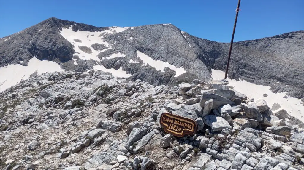
With a height of 2682m Tzarna Mogila is one of the peaks above 2500m in Pirin National Park. James from Coliving Avalon created a nice challenge called The Davies. During this challenge you hike in Pirin National Park and tick off all these peaks above 2500m: 90 in total! You can ask for a map and more info via Coliving Avalon.
Practical info for this hike to Tzarna Mogila
Starting point: Banderiska Polyana, aka the upper gondola station. It’s possible to go up with the gondola and start the hike from here. There is a parking space here as well, so you can also drive up by car or take a taxi. These are the Google Maps coordinates for Banderiska Polyana.
Total kilometers: 9-11 kilometers in total
Elevation: 1200 meters up and down (about 900 to the abandoned ski lift, 300 more to the peak)
Hiking time: 6 to 7 hours
Type of hike: point-to-point, same way back
Dog friendly: my dog Bella has joined this hike. She is very active, but I can imagine most fit dogs would be able to join this hike. There are no lifts or ladders involved. Usually you won’t encounter any shepherds with their cattle in this area, so no sheep dogs that can bother your dog here either.
Hiking trail: you can open the Tzarna Mogila hike on Mapy.cz via this link
Prepare yourself for the Tzarna Mogila hike, via abandoned slope nr 14
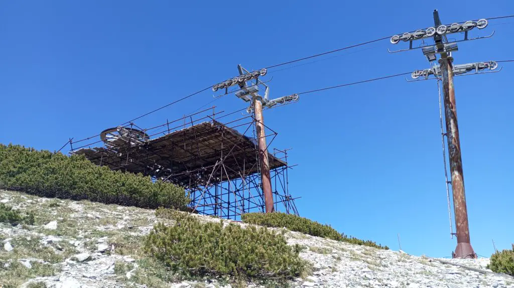
Anyone who ever checked the ski map of Bansko gets a bit confused. There is one red slope on the right side of the map, but when you look for it in real life it seems invisible. Ski slope number 14 has been closed for years and years now. The chance of avalanches was too big on that side of the mountain, so they closed the lift. But somehow they forgot to take it from the ski maps (might have something to do with the amount of kilometers or red slopes for the ski resort?).
Anyway, so it hasn’t been possible to ski here for years. They never bothered to take down the ski lift, so it’s quite a fun hike to this old ski lift via abandoned ski slope 14.

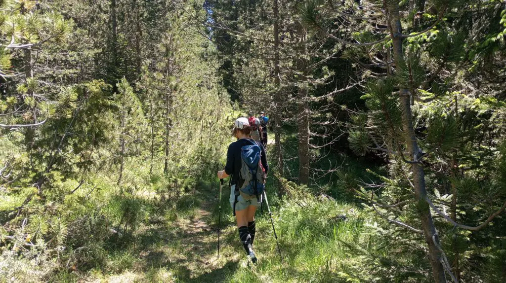
Start at Banderishka Polyana (upper gondola station)
You start the hike from Banderishka Polyana, the upper station of the gondola. You can go up with the gondola, but there is a free parking lot as well, so you can also go up by car.
If you’re really into some adventure, you can even start from Bansko and hike up via the ski road to the upper gondola.
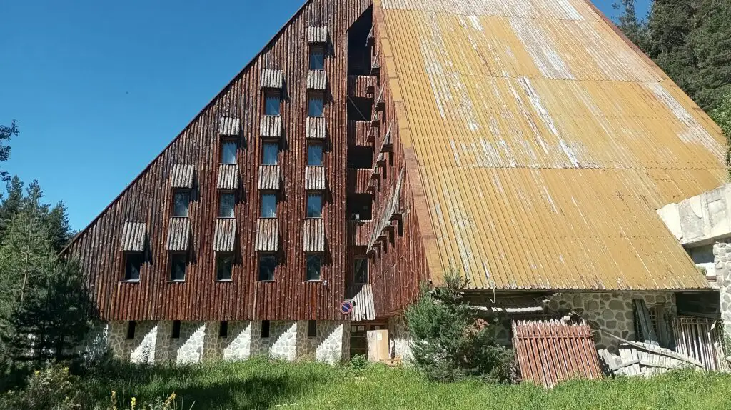
Once you’re here you will walk up towards the abandoned hotel: Academica Hut. It’s a bit of a search once you reach the Academica Hut. There should be a hiking trail going up to Tzarna Mogila, but to be fair: we couldn’t find it. Or it was overgrown and we just didn’t feel like pushing ourselves through bushes.
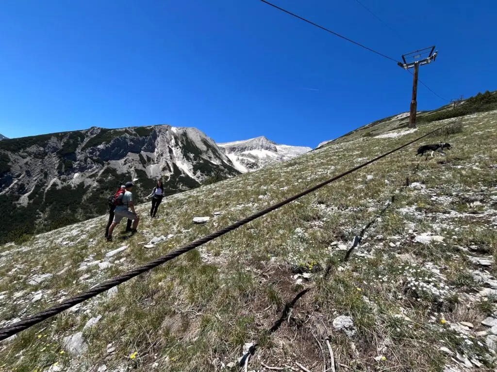
Follow the lift line uphill to the abandoned ski lift
So instead we decided to follow the hill up, following the ski lift line.
It’s quite steep and wild, so I can imagine that not everyone loves a hike like this one. But I think it’s amazing that there is a place that you can visit where basically nobody else goes to. We hiked for a good 6 hours that day and we didn’t see anyone else!

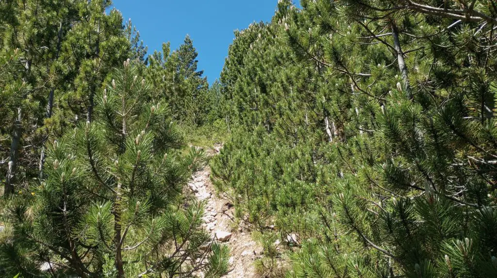
After a while climbing underneath the ski lift line (and I meant literally sometimes climbing and pulling yourself up haha), it’s possible to go to the right and you will see the trail (again). It’s not marked or anything, but it looks like a path that you can follow.
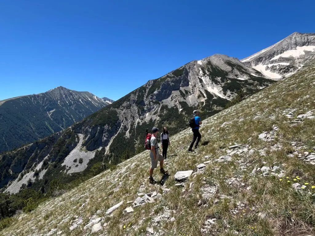
The more you go up, the more open it will be. It doesn’t get easier though, I think the steepest part was the last part. It didn’t help that it was right in the open at the hottest moment of the day. I kinda zigzagged on the mountain to avoid steep climbing, while the others tried to take the shortest route. Since there is not an official trail on this part anyway you can do whatever you want. You can’t really get lost at this part, because you can focus on the abandonded ski lift all the time.
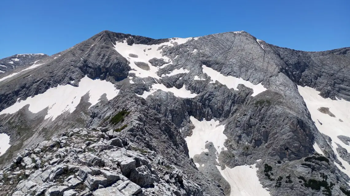
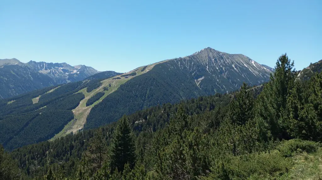
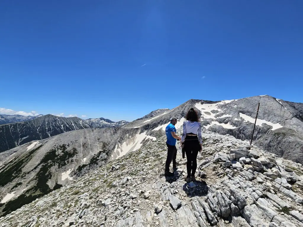
It’s lovely to have a nice view on the Todorka peak and the slopes from here, that have changed colours from white to green. And the more you go up the more you will see Kutelo and some other peaks as well.
Also Read: Hike To The Mighty Todorka Peak – 3 Different Routes To Get There
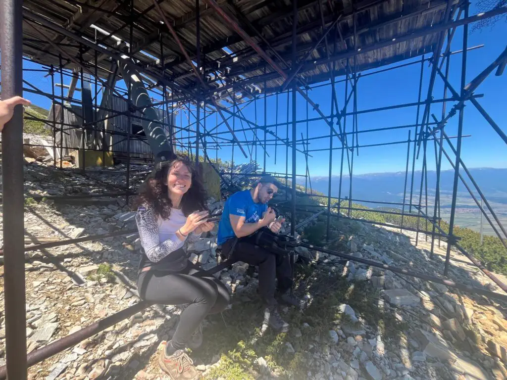
From the abandoned ski lift to the peak of Tzarna Mogila
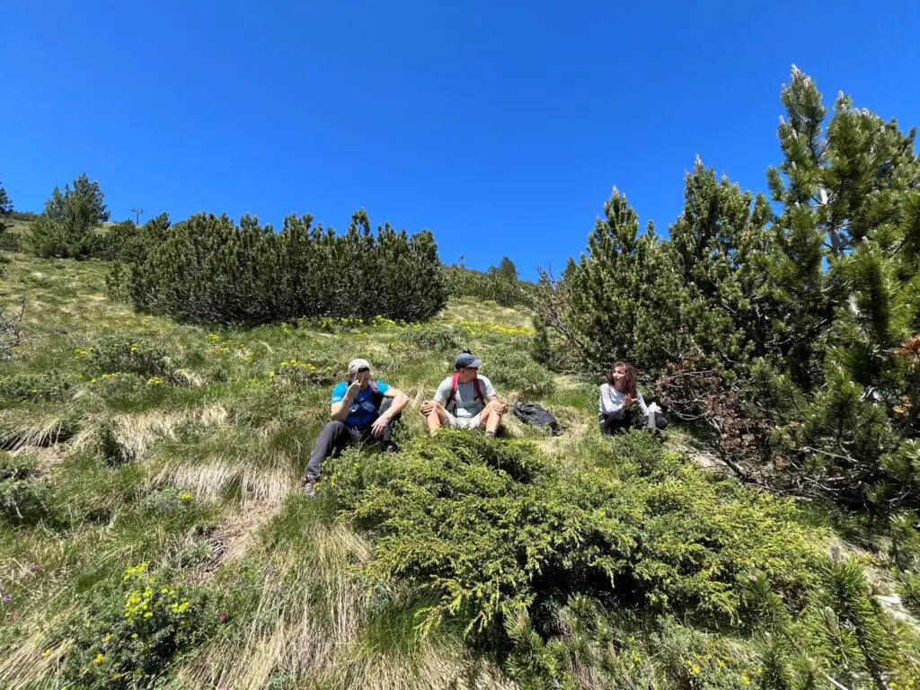
The abandonded ski lift is a good place to enjoy some shade and have a snack. Obviously you won’t find any huts or places to buy anything along the way, so make sure you bring enough snacks and water for the entire hike.
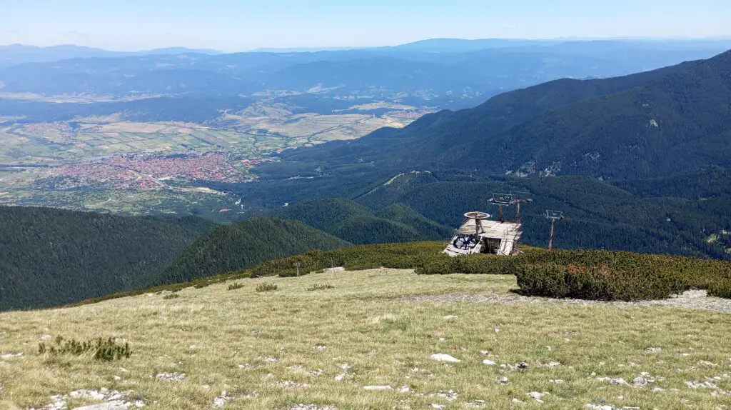
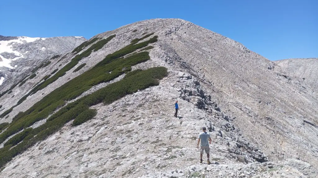
The hike from the lift to the Tzarna Mogila peak is not that far, but I would say it’s still an extra 1-1,5 hours of walking up and down. From the ski lift to the peak it’s about 300 meters up. Again: there is not really a specific trail, but you can’t really get lost or miss it. It’s just going up once you pass the ski lift.
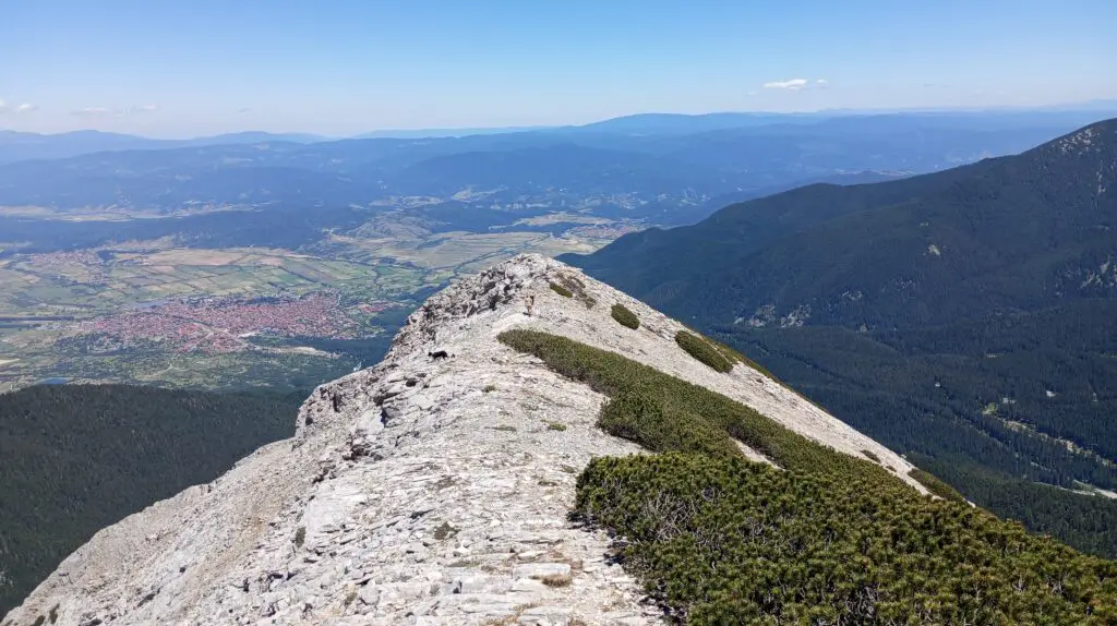
Don’t forget to turn around every now and then. I think it’s pretty awesome that you could see Bansko and the entire valley from here!
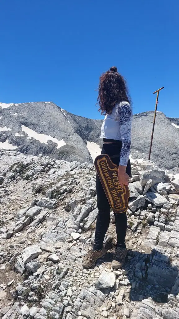
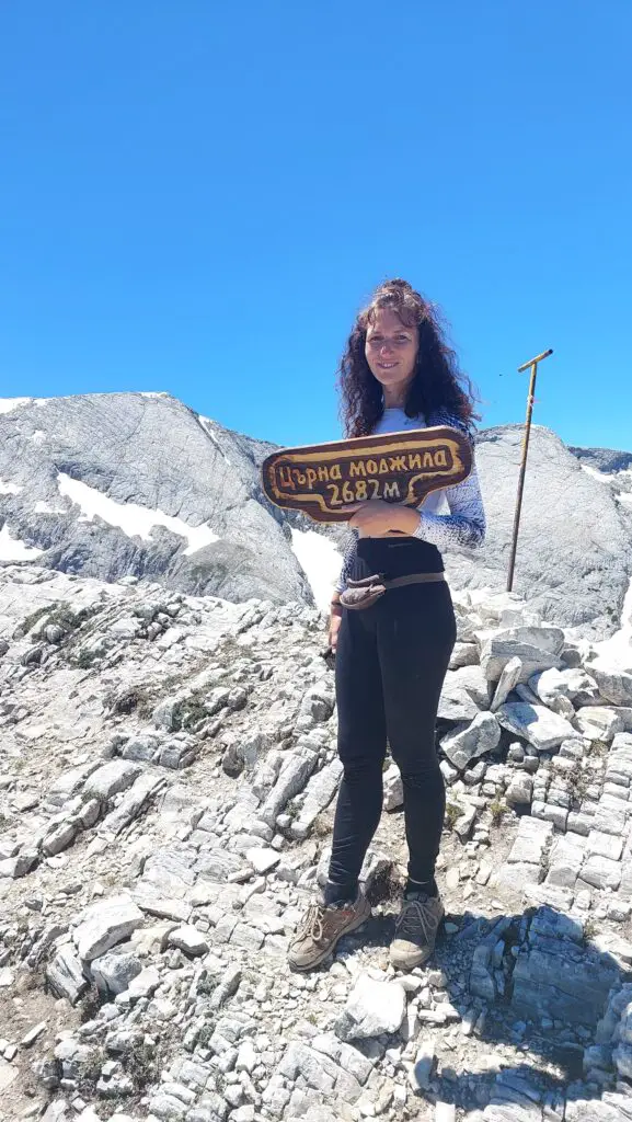
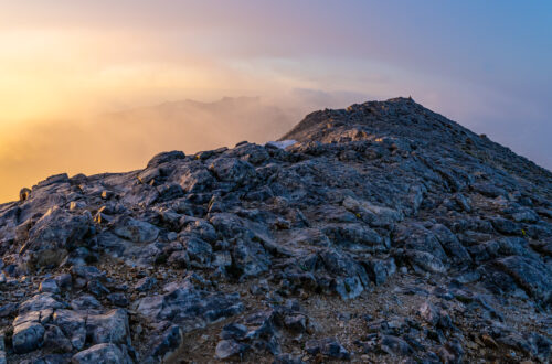
At the peak you will see a wooden sign, but if you dare you can walk a bit further on that ridge as well to enjoy more views.
Going back to Banderishka Polyana is pretty much the same way as you came up. Just keep an eye on the lift line and your GPS and you should be fine.
What to bring for the hike to Tzarna Mogila?
Since there is nothing along the way, you should bring all your water and snacks for the hike from the start. I haven’t seen any options to refill water along the way, so I suggest bringing at least 2,5 to 3 liters for your hike.
The time of the year influences what you have to bring for this hike. I would recommend to use layers for your clothes, since you’re in the mountains and most of the year it’s quite chilly. I did this hike in June and although it was quite warm, I can imagine it’s more chilly when it’s a windy day.
I would recommend bringing the following for your hike:
- Water bottle or Camelbak
- Snacks and lunch
- Water- and windproof jacket
- Hiking shoes or comfortable shoes to walk
- Hiking poles to stabilize yourself on the big rocks (not necessary, but some people love it)
- Beanie to keep your head warm or a cap to keep the sun out of your face
- Sunglasses for a sunny day
- Sunscreen, since the sun can be quite intense in the mountains
- First Aid Kit, because you never know when you need it
- Phone + powerbank
- Camera gear
I hope this article is useful if you’re planning to hike to Tzarna Mogila as well. Please let me know if you have any questions via the comments below or by sending a message to jessica@explorebulgarianow.com.
Disclaimer: this page might contain affiliate links. This is a free website, but of course it takes time and energy to gather information, take pictures and videos and create articles to help you. Via affiliate links we get a commission if you buy or book something online. At no extra cost for you! See it as a little thank you for this information. 🙂


You May Also Like
Hike To Vihren Peak For Sunrise (July Morning Tradition!)

How Much Is The Cost Of Living In Bansko For 1 Month [In 2025]?